
Description
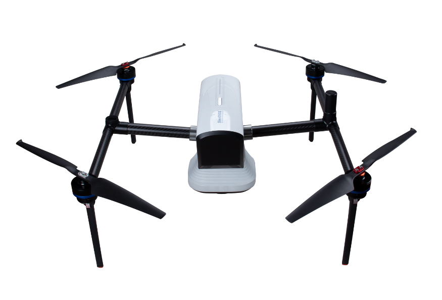
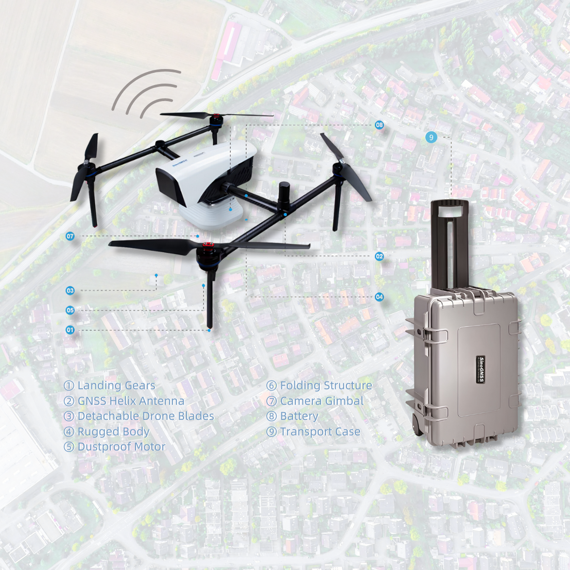
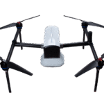
The E300 RTK Drone is a professional-grade quadcopter designed for aerial surveying, mapping, and 3D modeling applications. Powered by ComNav’s advanced K8 GNSS platform, it delivers centimeter-level positioning accuracy without requiring ground control points (GCPs), making it a reliable solution for surveyors, engineers, and GIS professionals.
Built for endurance and precision, the E300 combines RTK and PPK redundancy, modular payload flexibility, and intelligent flight software—allowing you to collect accurate geospatial data efficiently, even in complex terrains and harsh environments.
Key Features
📡 RTK/PPK Dual Positioning
Equipped with a high-performance GNSS module and EVENT synchronization, the E300 achieves centimeter-level accuracy for photo positioning. Both RTK and PPK methods are supported, ensuring data integrity even in weak-signal or post-processing scenarios.
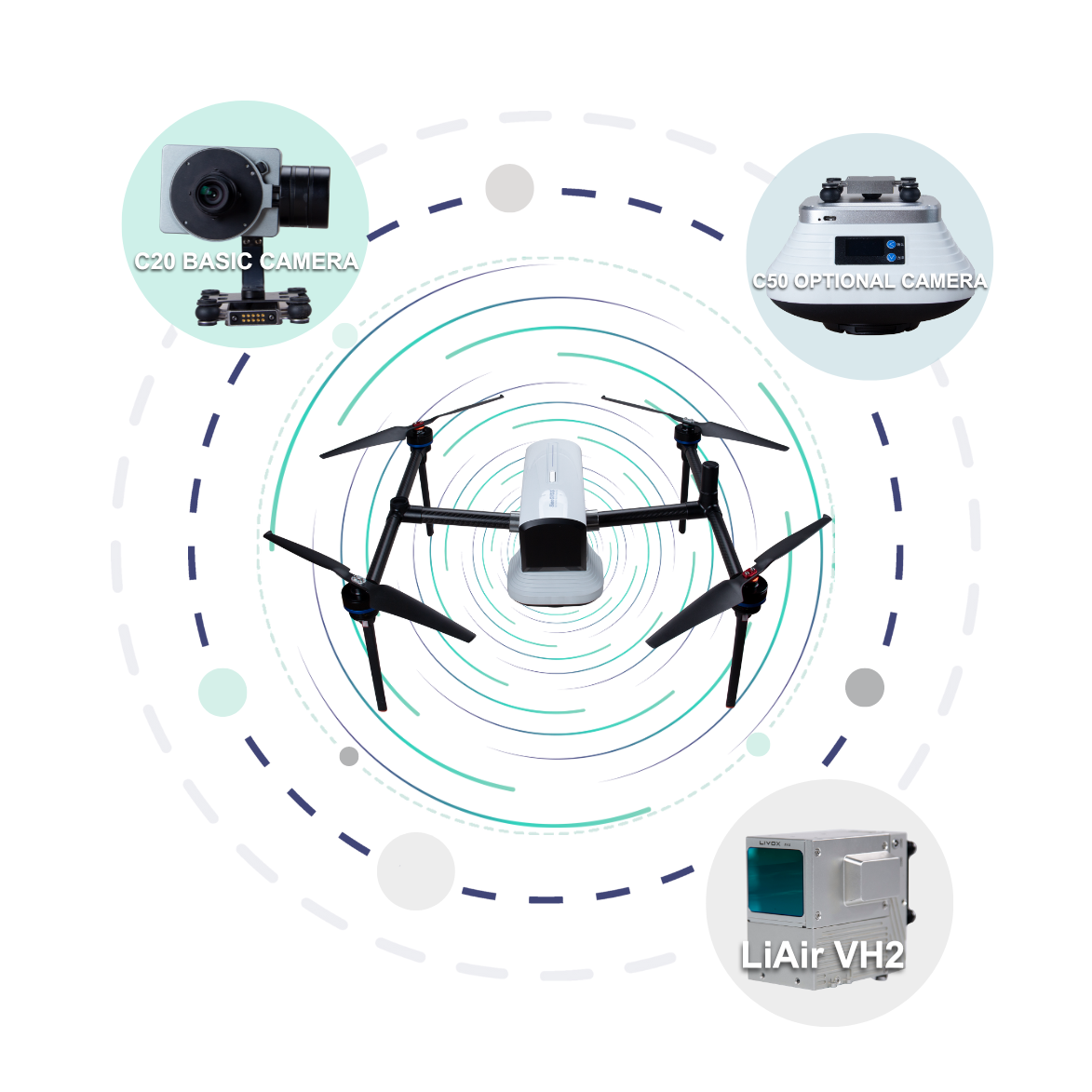
🔧 Modular Payload Bay
The E300 is designed with a quick-release payload system, enabling easy swapping between compatible sensors and cameras. It supports multiple payload types including:
-
High-resolution mapping cameras (e.g., C20, C50)
-
LiDAR systems (e.g., LiAir VH2)
-
Custom payloads up to 3 kg
🔋 Extended Flight Time
With its high-efficiency power system, the E300 can fly:
-
Up to 60 minutes without payload
-
Up to 50 minutes with a 1 kg payload
This allows coverage of up to 10 km radius per flight.
🌐 Terrain-Adaptive Imaging
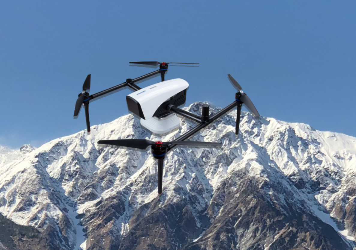
Thanks to intelligent terrain-following algorithms, the E300 maintains consistent image resolution and accuracy even over slopes, hills, or uneven terrain—making it perfect for large-area mapping projects.
🛡️ High Wind Resistance & Portability
The rugged design offers wind resistance up to 17 m/s and a wide temperature range (–30°C to +50°C). The foldable structure allows quick setup in less than one minute, making it easy to transport and deploy on-site.
Technical Specifications
| Feature | Specification |
|---|---|
| Drone Type | Quadcopter |
| Positioning | GNSS RTK/PPK (GPS, BDS, GLONASS, Galileo, QZSS) |
| Accuracy | RTK: ±8 mm + 1 ppm (horizontal); ±15 mm + 1 ppm (vertical) |
| Max Flight Time | 60 mins (no payload), 50 mins (~1 kg payload) |
| Coverage | Up to 10 km radius per flight |
| Max Wind Resistance | Up to 17 m/s (Beaufort scale 7) |
| Operating Temp | –30°C to +50°C |
| Takeoff Weight | Approx. 6.5 kg (with full payload) |
| Max Payload | Up to 3 kg |
| Assembly Time | Less than 1 minute |
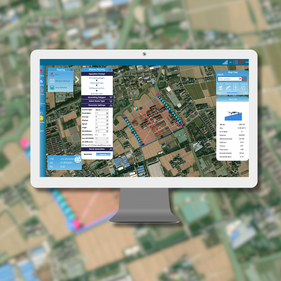
Smart Flight Software
The E300 is supported by intuitive flight control software offering:
-
Automatic route planning
-
Terrain following
-
Pause/resume flight
-
KML import
-
Real-time battery monitoring
-
Emergency return-to-home (RTH)
Compatible with Post-Processing Workflows
Using ComNav’s Compass Solution software, the E300 can convert flight data into precise deliverables for:
-
Orthophotos
-
3D models
-
Topographic maps
-
Volume calculations
-
DEM/DSM generation
Applications
The E300 RTK Drone is ideal for:
-
✅ Land surveying & topographic mapping
-
✅ Construction site modeling
-
✅ Forest and vegetation monitoring
-
✅ Mining & volume calculation
-
✅ Urban planning and cadastral work
-
✅ Emergency disaster response
-
✅ Coastal and riverbank surveying
Why Choose the E300?
If you’re looking for a high-precision, GCP-free mapping drone with long endurance, modular design, and rugged performance—the E300 RTK Drone is built to meet the toughest demands in professional surveying.
Reviews
There are no reviews yet.